
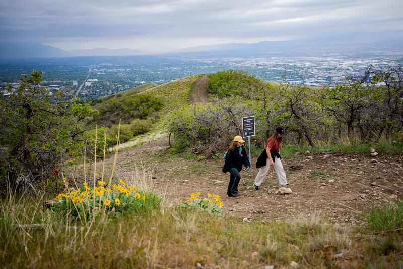
Across most neighborhoods lining the Wasatch Front, venturing beyond the urban zones and ascending into the hills reveals a network of paths crisscrossing where the edge of an old lake once lay. These routes collectively form the Bonneville Shoreline Trail.
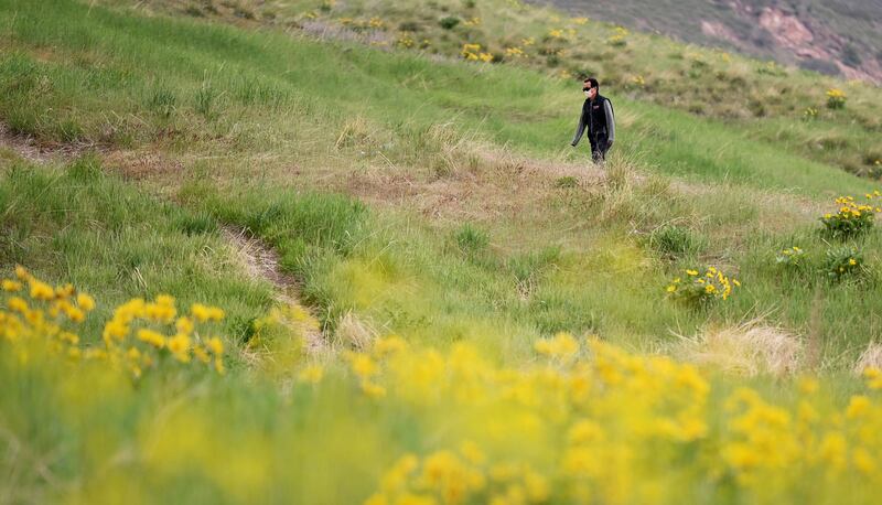
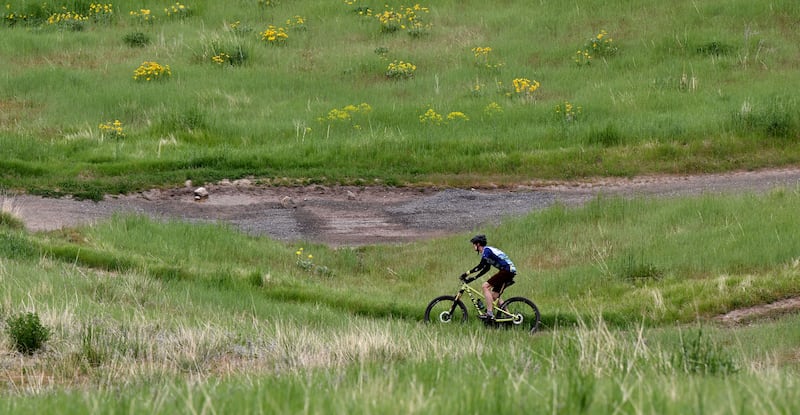
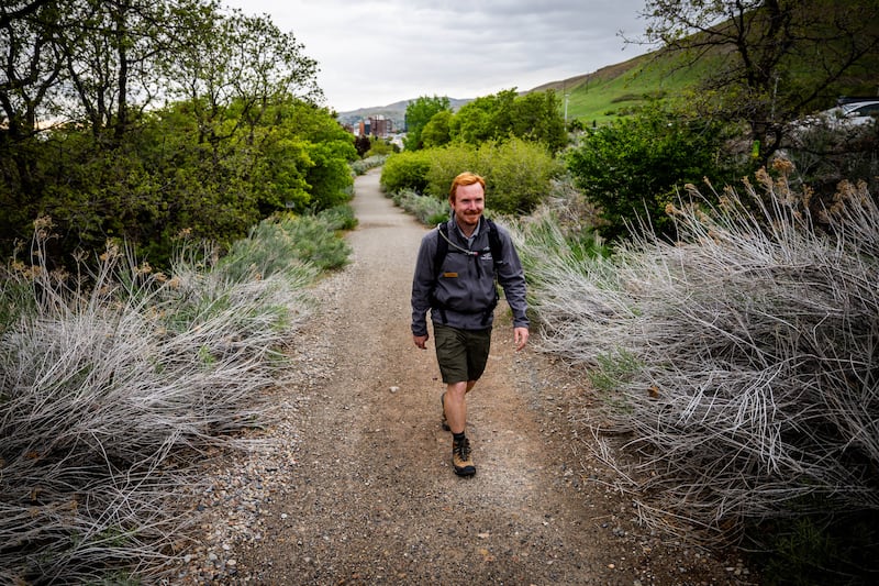
The trail segments spread across thousands of acres vary greatly from one another; some follow paths flanked by dense foliage and vibrant wildflowers, others traverse rugged slopes and boulder-strewn areas, and still others offer views of expansive ravines and deep gorges.
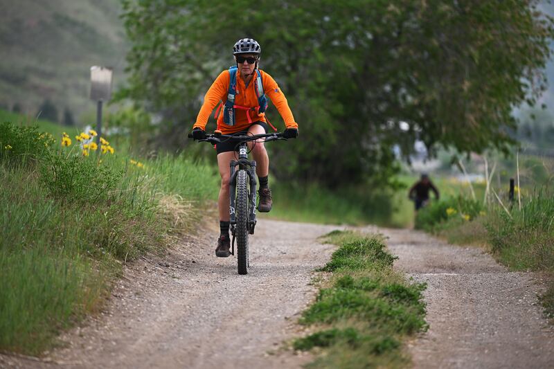
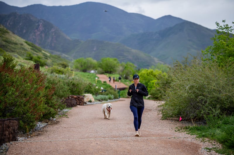
For many years, bikers, trail runners, and hikers have relished this path despite its evolution and expansion through the decades.
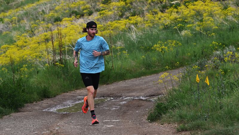
People who utilize the trail, whether they are seasoned professional trail runners or individuals who enjoy running casually after their daily work, have expressed appreciation for its accessibility and how it caters to all types of participants.
“I believe accessibility has always been key to the style of trails around Salt Lake City,” stated Grant Barnette.
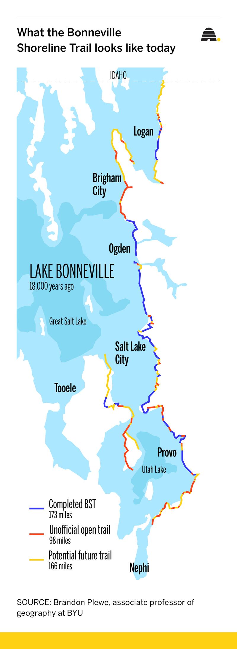
The path tracing the former shores of ancient Lake Bonneville remains unfinished; however, it has expanded significantly during the past thirty years. This growth is due to various towns along the Wasatch Front connecting their segments piece-by-piece.
Initially, the journey started with Salt Lake City as its main point, yet the scope has expanded significantly since those early days. Nowadays, the route spans more than 170 miles following the ancient shoreline of Lake Bonneville on its eastern side, linking numerous towns throughout Utah.
Carly Lansche, who serves as the trails and planning program director for the Utah Division of Outdoor Recreation, stated that the aim is to create an uninterrupted path designed for non-motorized travel extending from Nephi in Juab County up to the boundary with Idaho.
“The consistency of this network throughout our densely inhabited regions is quite compelling. We have Interstate 15 and various roadways slicing through our towns, binding us together. Similarly, our trails serve the same purpose but in a slightly distinct manner,” Lansche stated.
Supporters aim for the trail to eventually extend approximately 400 miles, linking pathways and towns throughout Utah.
“The state has shown significant interest in city connectivity,” stated Charles Wheeler, a previous mayor of Hyde Park, who has assisted in constructing portions of the trail in Cache Valley.
What sparked the beginning of the Bonneville Shoreline Trail?
The concept of the
Bonneville Shoreline Trail
It commenced in 1989. The initiative was launched to safeguard a trail for cycling, running, and walking along a route connecting Emigration Canyon and Dry Canyon on the eastern fringe of Salt Lake City.
A section of the trail goes through This Is The Place Heritage Park at the entrance of Emigration Canyon. When the park employees planned to enclose the region, numerous outdoor enthusiasts objected. These individuals did not wish to be excluded from the zone or obligated to pay charges. Ultimately, both parties reached an agreement, resulting in a fence being installed beneath the recreational path.
“Each time you encounter such an issue, there tends to be some crisis that prompts people to become engaged and organize themselves. This particular crisis served as the catalyst for individuals realizing they needed to take action to ensure permanent preservation,” explained Brandon Plewe, a geography professor from Brigham Young University specializing in map design.
At roughly the same period when the agreement was reached, Salt Lake City officially embraced the Bonneville Shoreline Trail as part of its trail network in the eastern and northern mountainous areas bordering the city. The Bonneville Shoreline Trail Committee came into existence in 1991 with the aim of advocating for the expansion and implementation of this trail across various parts of Salt Lake County.
Ultimately, regions such as Davis County and Utah County started adopting the Bonneville Shoreline Trail designation for their existing trail systems, including plans and sections that were already underway in these locations.
In 1994, officials from Utah, as well as Salt Lake, Davis, and Weber counties, agreed that they wanted to create an uninterrupted trail along the former shorelines of the historic Lake Bonneville.
Ever since then, numerous distinct communities and organizations have taken ownership and expanded various segments of the path, extending it to its current length of 170 miles.
“The Bonneville Shoreline Trail exemplifies a legacy, essentially a vision that spans multiple generations,” Lansche stated.
The Bonneville Shoreline Trail is a mosaic stretching along the Wasatch Front.
Plewe developed an interest in the Bonneville Shoreline Trail about two decades ago, when he was involved in creating a street map of the Wasatch Front and wished to incorporate the local trails into his work.
As he gazed at the path ahead, Plewe found it difficult to discern which sections had been completed and which remained unfinished due to conflicting information from various sources.
“There are many questions surrounding this topic. In my work, I’m particularly drawn to areas involving uncertainty and those in an ambiguous state. So, I became intrigued by this subject, with the aim of clarifying what has been accomplished and what hasn’t,” he explained.
The Bonneville Shoreline Trail Committee remains in existence, yet it has gradually lost momentum over time, shifting the duty of building and upkeep of the trail to individual volunteers, municipalities, and various organizations.
“Basically, throughout this entire process, it has been quite disjointed since no one person is truly overseeing it,” Plewe stated.
The duty of maintaining the trail has been placed upon people such as Wheeler, who assisted in securing funds and obtaining land for portions of the trail within Cache Valley. Additionally, he has contributed to constructing these trail segments.
Although approximately 170 miles of the path have been finished, they aren’t fully linked together yet. What exists now as the Bonneville Shoreline Trail consists of various parts including officially developed segments that are kept up nicely, portions needing improvement, former roadways, informal tracks, along with significant breaks between different areas.
Jen Hollingsworth, an employee at the University of Utah Hospital, frequents the Bonneville Shoreline Trail for cycling or jogging about three days per week, often solo but also occasionally accompanied by friends or colleagues.
Hollingsworth mentioned that she believes extending the Bonneville Shoreline Trail extensively throughout the state of Utah presents a fantastic opportunity.
“The concept of linking communities, counties, and eventually even states together seems amazing to me, and I genuinely hope we achieve this someday,” she stated.
What new features have recently been added to the trail?
Up until now, 170 miles of the path have been finished since the concept was initiated in 1990. Throughout the years, the ambitions regarding the extent of the trail have evolved; however, according to Plewe, they presently aim for approximately 400 total miles.
Recently, updates were made to the trail with about a 6-mile segment being added in the Herriman region during 2023. Additionally, new territory has been secured for the pathway close to the Battle Creek Trail in Pleasant Grove.
Recently, in Hyde Park within Cache Valley, Wheeler assisted in completing a segment of the trail after approximately three years of construction. This particular stretch, which measured around two miles long, stood as the most extensive single-section project completed up until then.
Cache County has been granted funds by the state to construct additional segments of the trail. These new parts will be built in stages, extending both northward and southward from the Hyde Park area.
Throughout the years, Plewe has dedicated himself to charting the path of the trail and identifying which parts have been completed and which haven’t. In an effort to disseminate his findings about the trail, he initiated a YouTube series in 2021 titled “State of the BST.”
In all 32 video segments, he treks the complete distance of the Bonneville Shoreline Trail, providing his audience with an up-to-date look at the condition of the path and insights into how each section developed over time.
“I am hopeful that we will gain significant insights into the trail’s history, its current state, and what lies ahead,” Plewe stated.
the series’ first video.
In what manner does the path get broadened?
A major hurdle in expanding the trail lies in navigating property and land ownership issues.
When examining a parcel map, one notices an assortment of various geometric forms,” explained Lansche. “In Utah, our state has strong inclinations towards protecting private property rights. Therefore, the key issue revolves around determining if the trail lies on publicly owned land or privately held land. Additionally, it depends on whether the respective landowners have consented to allowing such access.
Due to this, land must be obtained incrementally, and if the owners do not wish to participate, there isn’t much that can be done. Lansche mentioned that she recognizes certain advantages for those landowners who permit public recreation trails across their privately-owned lands.
“It requires an extensive period to implement the vision,” Lansche stated. “However, I believe that once people become enthusiastic about it, it frees up several parts that had been stagnant.”
According to Wheeler, various factors should be taken into account during the construction of the trail. It must be positioned at an elevation that prevents it from overlooking home windows or private yards, and ideally placed to offer scenic vistas. Additionally, ensuring the path facilitates effective workouts and remains readily approachable for users are key aspects to consider when developing new segments.
In March, Senators Mike Lee and John Curtis from Utah introduced the bill.
Bonneville Shoreline Trail feasibility study act.
If approved, this legislation would mandate a study of the trail to determine if it meets the criteria for designation as a National Scenic Trail or should be granted another status within the National Trails System.
Plewe mentioned that obtaining a national designation could simplify access to federal funds for the trail. Additionally, this designation would streamline organization efforts since every National Scenic Trail has an associated group responsible for coordinating upkeep and volunteer activities.
He mentioned that the designation wouldn’t compel private property owners to permit the trail to traverse their land.
Along the edge of the old Lake Bonneville coastline
The aim for the Bonneville Shoreline Trail is to trace the former edge of the vast ancient lake that once covered much of what is now Utah.
“It’s incredibly awesome how immense and extensive that area used to be,” Hollingsworth remarked while discussing Lake Bonneville.
Lake Bonneville
It was an extensive prehistoric lake that occupied the Great Basin during the later part of the Pleistocene Epoch, blanketing a significant portion of the western U.S. The Great Salt Lake is the remnant that remains from this former vast expanse of water.
However, as the lake gradually withdrew over millennia, it formed several terraces or ledges. Numerous towns in Utah, particularly those located along the Wasatch Front, have been constructed on these lower terraces. The Bonneville Shoreline Trail runs alongside the higher terraces.
“Pleasingly, following the Bonneville shoreline sounds good, however, it’s impractical in many regions,” Plewe stated.
Plewe mentioned that the optimal placement for trail segments usually lies at the periphery of built-up zones. These regions, where urbanization transitions into undeveloped natural landscapes, are referred to as the Wildland-Urban Interface.
Plewe explained that the concept involves having a path set at the simplest grade within the natural setting. “It should be quite flat and generally suitable for families throughout much of its length,” he added. “Our aim isn’t to climb all the way up to the summit.”
In what ways does the Bonneville Shoreline Trail enhance experiences for residents of Utah?
Wheeler has been active in the construction industry and has contributed to designing various roads, trails, and parks throughout his career. Impressed by the influence of trails, he became motivated to participate in the Bonneville Shoreline Trail project.
I observed just how crucial it is for families and individuals to go hiking and stay active, as well as for children to enjoy playing in parks,” Wheeler stated. “I’ve witnessed firsthand how parks and trails can enhance the overall quality of life for those who engage with them.
He mentioned that since the state observed the positive impact of the Bonneville Shoreline Trail in the Salt Lake City region, it has started acknowledging the importance of such pathways. Consequently, this realization has resulted in giving higher priority to the development and enhancement of both the Bonneville Shoreline Trail and other trail systems throughout Utah.
“You’re witnessing financial and economic effects resulting from these trails, with people actually visiting certain locations as a destination specifically for those activities,” Wheeler stated.
Lansche mentioned that outdoor activities rank among the highest priorities for residents of Utah. She further explained that due to the trail passing through numerous communities and featuring multiple trailheads, it provides easy access for individuals seeking a rapid getaway into the natural environment.
Barnette is an experienced trail runner who frequents the Bonneville Shoreline Trail near Salt Lake City four to six days per week. He enjoys this path due to its convenient location close to the urban area and its excellent upkeep.
It simply appears quite convenient, regardless of whether individuals have full-time jobs or are working remotely, that they can easily end their shifts and slip in a short run or pretty much any activity,” Barnette stated. “Ease of access is key here.
Hollingsworth mentioned that she values how the trail offers something appealing to every person.
“You could be part of a family with small children and manage to walk a significant stretch along the flatter areas, yet venture off the path to find quite challenging slopes. There are also advanced portions suitable for mountain biking. Thus, I believe this place caters to everyone regardless of their fitness levels,” she explained.


Leave a Reply