
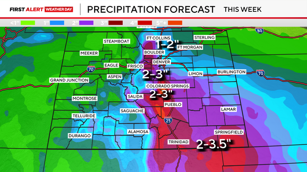
Persistent spring showers will keep expanding over Colorado. Between Monday and Wednesday, several inches of rainfall could occur in Denver and the nearby mountainous areas.
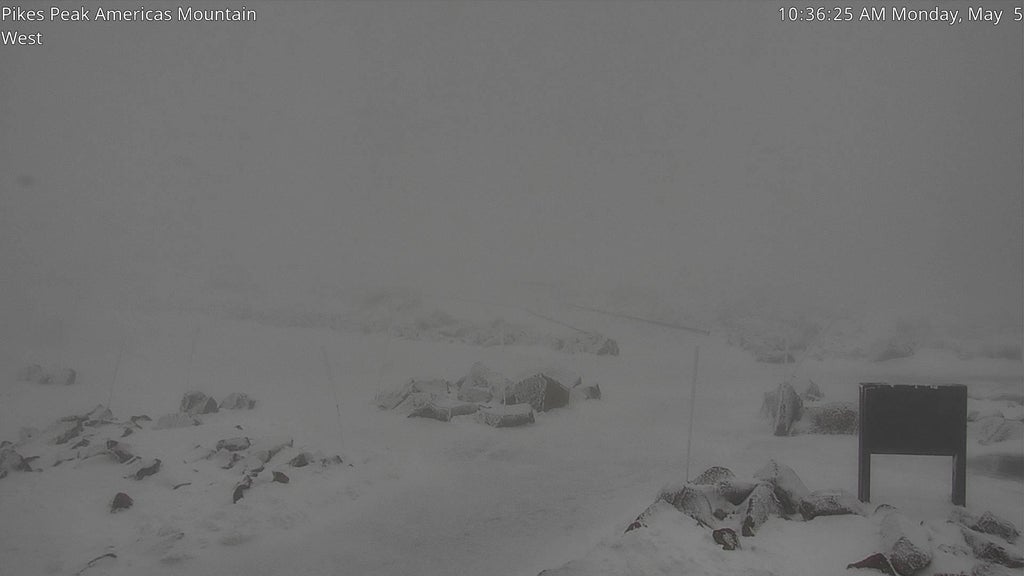
One of the most remarkable figures might be the anticipated 50 inches of snow set to accumulate on top of Pikes Peak by Thursday morning.
On Monday afternoon and into the night, precipitation will move over the entire state. The showers will be scattered across the foothills and plains regions. In the higher elevations of the mountains, both rain and snow showers are anticipated, with the transition between rainfall and snowfall occurring roughly around an elevation of 10,000 feet. For traveling through mountain passes on Monday, expect conditions suitable for winter driving particularly as you go up towards these elevated areas.
A break is anticipated overnight from Monday into early Tuesday. However, rain and snow won’t delay in covering the entire state, with continuous rainfall reaching Denver around 8-9 AM. The period of increased precipitation will persist throughout Wednesday. Expect widespread accumulations of 1-3 inches of rain over the foothills and Eastern Plains, providing desperately needed relief for the ongoing drought conditions.
Wednesday promises to be an adventurous day throughout the higher elevations. Expect heavy, moist snowfall that varies with altitude, potentially bringing significant accumulations. It’s quite common during springtime in Colorado, where even small changes in elevation—just a couple of hundred feet—can result in dramatically different weather conditions, from over two feet of snow at one spot to mere rainfall just down below. Should these forecasts affect your travel routes, vacations, or daily schedules, we recommend reading further details.
Allow me to begin with what we can firmly assert: The San Juan, Sangre de Cristo, Sawatch ranges, and Front Range mountains will experience an onslaught of moist, heavy snowfall. These substantial snow accumulations (as shown below) will lead to considerable disruptions for high-altitude travel.
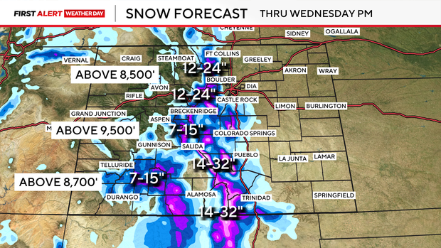
The most significant update to the weather prediction involves shifting heavy snowfall down to around 7,500 feet elevation. Consequently, locations like Conifer, Aspen Park, and Bailey can anticipate receiving between 6 to 12 inches of snow. Additionally, regions including Woodland Park and Divide should prepare for accumulations ranging from 10 to 15 inches.
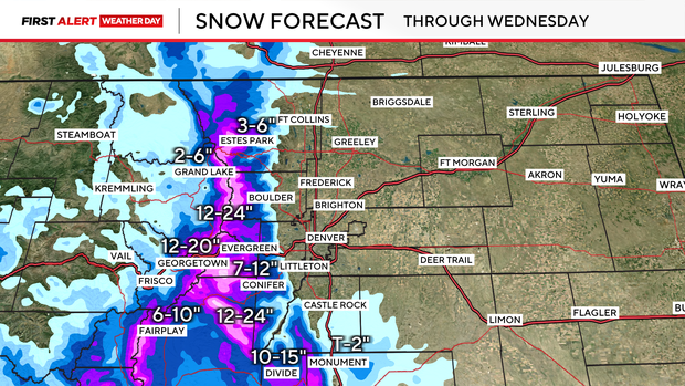
By late Tuesday night through early Wednesday morning’s rush hour, expect considerable disruption for travelers throughout the high mountain areas. This includes potential holdups and possible shutdowns on I-70, as well as Loveland Pass and Berthoud Pass. Specifically, between Georgetown and the Eisenhower-Johnson Tunnels, they’re forecasting 14 to 20 inches of snowfall.


Leave a Reply